Introduction
If road cycling is your thing, choosing Wales as a destination for an epic adventure would be a wise choice because there are lots of benefits to cycling in Wales, such as:
 Unrivalled scenery – all of Wales is beautiful but my favourite area is North Wales because of the sense of magic you feel from being overshadowed by the towering presence of Snowdon and Cadair Idris, which are two iconic mountains that can be seen from many parts.
- Quiet roads – Wales isn’t home to many motorways or dual carriageways, especially in Mid and North Wales, which provides reassurance for cyclists that they won’t be caught up in heavy traffic.
- The new 20mph speed limits – Wales is aiming to become a cycling-friendly country and the recent introduction of 20mph speed limits in residential areas and on some main roads certainly make the roads feel safer for cyclists.
- Friendly and helpful people – here in Wales you will come across some of the friendliest and helpful people on the planet who will always be willing to lend a hand if you’re ever in need of it.
- Plenty of designated paths for cycling – Wales has a good cycling infrastructure with routes running from North to South / South to North and East to West / West to East, most of which are traffic free.
If all of the above has whetted your appetite for taking a cycling trip to Wales, please read on to find out what I consider to be some of the best road cycling routes in Wales.
Please also note that these are routes that I’ve created myself from my many years’ cycling experience and could be tweaked to suit your individual preferences using any cycling route creator.
Mid Wales
| Route name | Distance | Climb (elevation) | Time | Important Information |
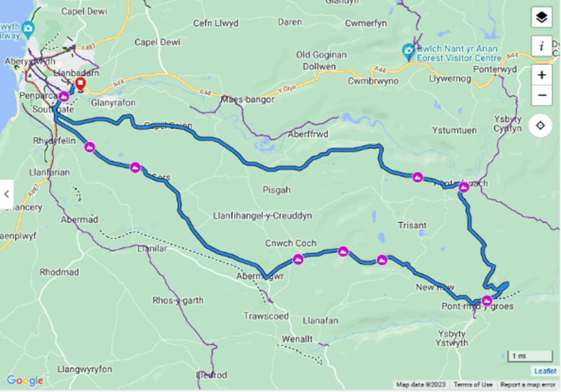
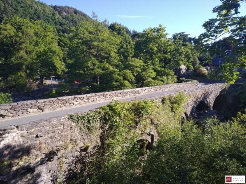
| Devil’s Bridge Loop | 46km / 29 miles | 2548 foot | 90-150 mins | This route includes a lot of elevation, but as it is being done on a road bike you should be able to complete it in a decent time as there a lot of quick descents, especially on the homeward journey which feels nice after all the climbing early on. |
Highlights of this route include passing the old mines at Pontrhydygroes, visiting the Two Hoots Tea rooms or the Hafod Hotel in Devil’s Bridge, stopping at Devil’s Bridge itself to learn about the history of the area and how long the bridge’s have been there for, and the fast final 10 miles back towards Aberystwyth where you will get unrivalled views of the town and it feels spectacular when you can start to see the sea and watch as it gets closer.
One other top tip is if you get chance, stop at the Half Way Inn which is located on the way back to Aberystwyth for a cracking pint of beer.
| Route name | Distance | Climb (elevation) | Time | Important Information |
| Mawddach Trail | 15.2 km / 9.45 miles | 297 foot | 30-60 mins | This route is a brilliant family ride across a mainly flat surface that is traffic-free.
There’s hardly any elevation and it can also be cycled in both directions, with plenty of facilities and shops at either Barmouth or Dolgellau. |
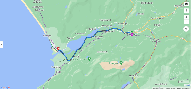
This route forms part of Lôn Las Cymru (National Cycle Network Route 8) which runs from Holyhead to Cardiff, so you can expect to find a well maintained cycle route.
The scenery is fantastic and you will be overshadowed by the amazing Cadair Idris for your ride, before arriving at the picturesque seaside town of Barmouth, where the obligatory ice cream awaits! Be sure to also look out for the iconic wooden bridges and make some time to stop for some family photos.
North Wales
| Route name | Distance | Climb (elevation) | Time | Important Information |
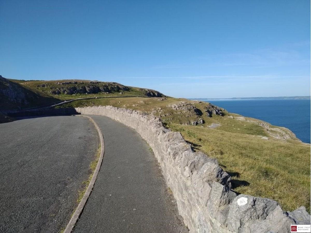
| Llandudno Great Orme | 8.9km / 5.5 miles | 397 foot | Approx 30 mins | It’s best to follow this route anti-clockwise to follow the direction of motor vehicles. Be careful of pieces of rock which can occasionally come loose from the cliff face and litter the road surface. |
The imposing Great Orme can be seen from miles away and you would be forgiven for thinking this is going to be a killer of a climb. There’s no need to worry – as cyclists of all abilities can tackle this route, as there’s respite after every hill when the terrain flattens out. Think of it as a short, sharp blast!
This route starts off by Llandudno’s pier and skirts around the edges of the Orme – to fully appreciate the stunning sea view it’s best to ride this route on a clear day with blue skies.
A common mistake is to go full gas on the first hill, however the most demanding hill is towards the summit so make sure you’ve got something left for the end.
Once the cafe is in sight you’ll know that you’re nearing the end of the climb, and can enjoy an exhilarating downhill section – breathing in sea air into your burning lungs.

| Route name | Distance | Climb (elevation) | Time | Important Information |
| Ogwen Valley Loop | 76km / 47 miles | 2,326 foot | Approx 3-4 hours | The road between Betws Y Coed and Bethesda can be quite busy with vehicles, so it’s best to complete this route early in the morning or late in the evening during Spring/Summer when there’s plenty of natural light. |
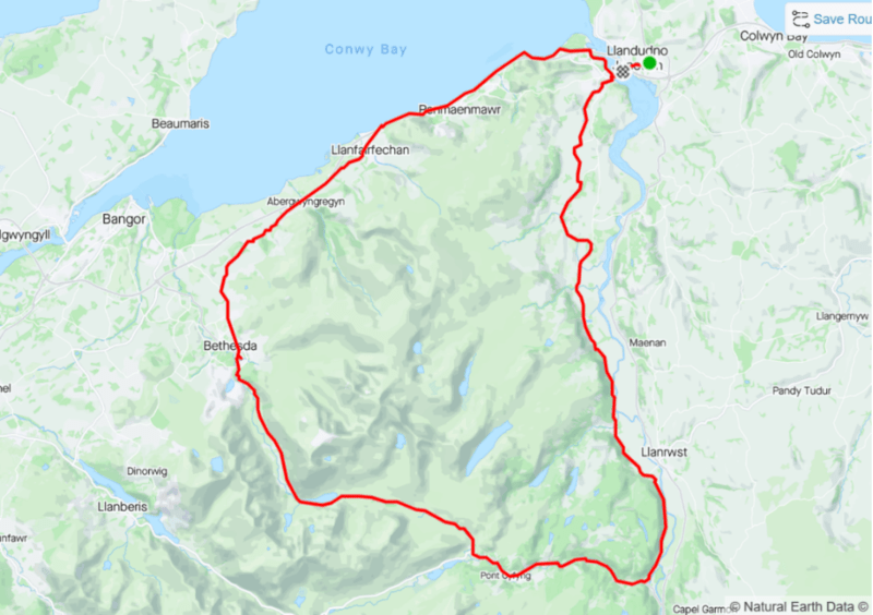
This route is one of my favourite as it has so much variety. You’ll be riding through lush green country lanes, underneath cool pine tree canopies, through the heart of Eryri’s (Snowdonia’s) mountains and finally side by side with the blue sea on the coast.
The route starts and ends in Llandudno Junction, where upon your return you can enjoy a well earned coffee and cake at the excellent Providero Coffeehouse. This route avoids the busy A470 road, and takes you through the much quieter villages of Henryd, Rowen and Tal-y-Bont.
The most challenging section is the uphill grind from Betws Y Coed to Llyn Ogwen, but there is a fantastic descent down to Bethesda to repay you for your efforts.
| Route name | Distance | Climb (elevation) | Time | Important Information |
| Marchlyn Mawr | 8km / 5 miles | 1,093 foot | 45 Minutes | A gate at the start of the climb stops any cars from using the path. The route is mostly used by cyclists and walkers and has a nice surface to ride on all the way to the top. |
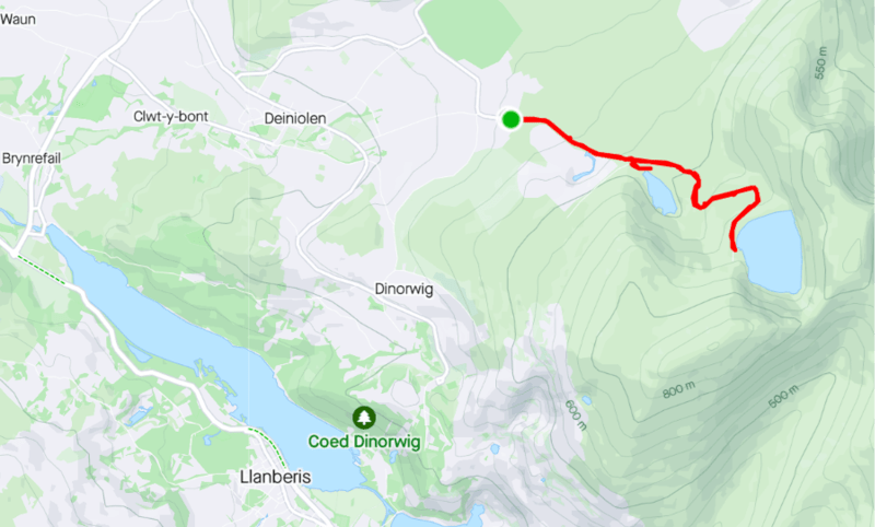
Marchlyn Mawr is a reservoir that sits on top of a very large and steep hill that feels like it’s on the summit of a mountain. A bike with low gearing is best, to help cope with the relentless climb to the top – a road bike or mountain bike can be used as the path has an excellent surface to ride on.
The views at the top are breathtaking, and among the best that the local area has to offer. The route itself is a hidden gem, you’re unlikely to be aware if it unless you’re familiar with the area.
Final Words

From the serene valleys of Mid Wales to the majestic heights of North Wales, these cycling routes truly encapsulate the beauty and charm that this region has to offer.
Stay tuned for more, as we’ll soon be exploring the hidden gems of South Wales too. Whether you’re an avid cyclist or a casual enthusiast, Wales beckons with its winding roads and captivating vistas.

Mike is an experienced road cyclist and mountain biker and splits his time between the two disciplines. In his spare time he can often be found tackling the big hills and mountains of mid-Wales, attempting to beat his previous times

")